My own POIs and distance and area measurement
own POIs on the map, share them and use them to find GPS coordinates.
 You can find both tools in the bottom right corner of the map under the "Tools" button. You find description of both features below:
» Add own POIs
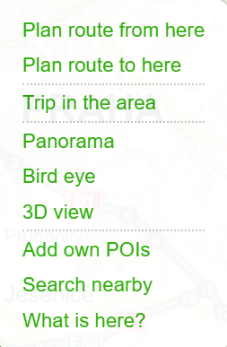
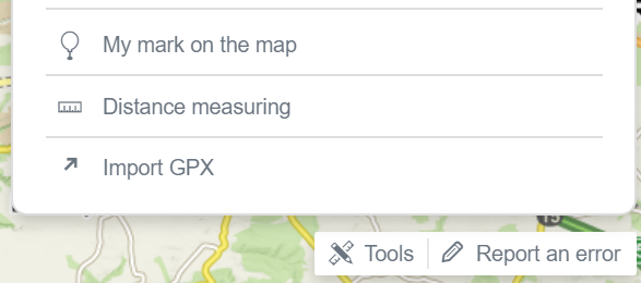
With this tool you can find GPS coordinates and add custom POIs. To create your own POIs click on the Tools button in the bottom right corner, select the option My own POIs and then click on the desired area on the map. You can also add a custom POI by clicking the right mouse button on the map and selecting the option Add own POIs.
You can change the title of the newly added POI and save it by pressing the Save button. The GPS coordinates of the POI are also displayed immediately.
Each custom POI can be Saved to My Maps, Shared or Exported to GPX or KML file.
You can create more POIs by clicking on the map. Individual POIs can be moved on the map using drag-and-drop. Location and GPS coordinates will be automatically recalculated.
You can remove a POI by clicking the trash bin icon. By clicking the Edit button you can change the POI title or copy the GPS coordinates.
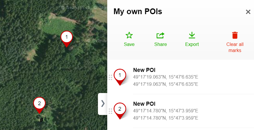
The custom POIs added on the map are not permanent (you need to save the POI in My Maps to maintain it) and not visible to anyone else (this can be done only via Sharing).
To permanently insert your business on Mapy.cz, please create a free business listing on Firmy.cz.
If you are interested in placing a map on your own website, please refer to the license conditions of a specific map-type vendor or application interface services (API Maps).
» Distance measurement
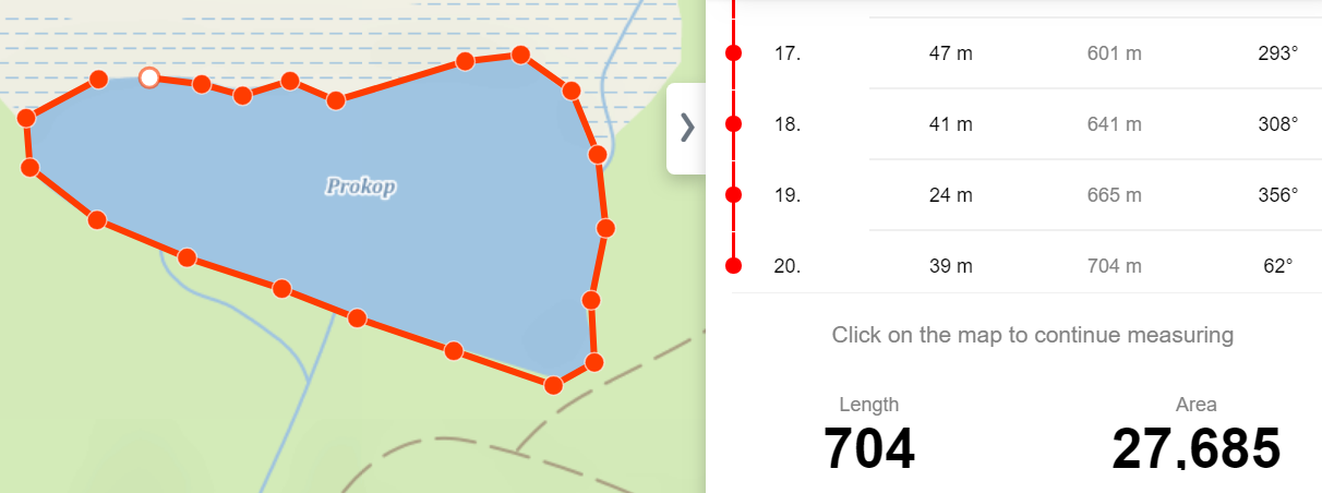
The tool for manual measurement allows you to measure the distance between two points on the map by "beeline".- To create points, click the Tools button at the bottom right corner of the map and select Distance and Area Measurement.
- Click the desired location on the map. Each click creates a point on the map. Similar as with a scheduled route, you can move or add a new point by clicking and dragging of an added point or a line segment.
From the first selected point, the distance is calculated to the mouse cursor position, so for measuring distance between two points there
is no need to select the second point, just move the mouse pointer over it, the distance will be continuously modified and displayed.
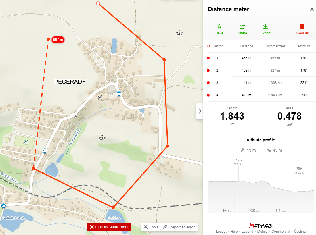
The measured path is shown with its elevation profile and the distance between points, total distance and azimuth.
Each measured path can be Added to My Maps, Shared or Exported as a file for GPS navigation (in GPX and KML format).
To measure the length of hiking routes and biking trails more accurately, use the function Planning. It is enough just to enter the start and end points of your route. The route between the two endpoints will be planned automatically and the distance measurment, including the elevation profile, is displayed too.
» Area measurement
If you specify more than two points with the measurement tool, the area is displayed next to the length of the specified path. It is notnecessary to close the measured area, the tool automatically connects the first and the last point.