What are tactile maps and who are they for?
Tactile maps are maps designed to be read by touch. They are primarily designed for blind and partially sighted users.
Unlike standard maps, these maps need to be printed, but it's not rocket science.
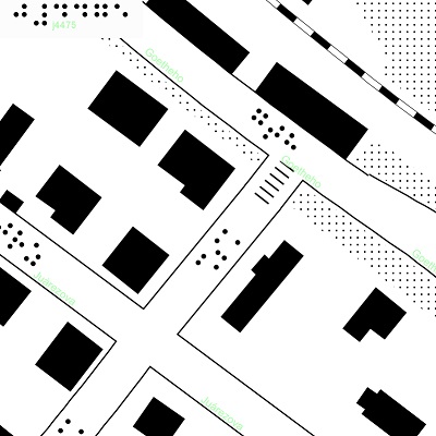
For easier touch perception, similar elements were visually merged by using cartographic generalization.
Tactile maps are currently available not only for the Czech Republic, but also for the whole Europe.
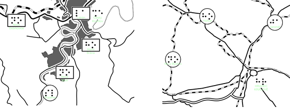
In maps with smaller scale, the names of the settlements are analogically marked with abbreviations of two letters in Braille and full names in light green color.
or if you do not know how to print the map, contact one of the partner centers, where they will help you to print your maps.
Unlike standard maps, these maps need to be printed, but it's not rocket science.
How to gain tactile maps
For more detailed instructions on how to prepare tactile maps and how to print them, click here.Design of tactile maps
The elements contained in tactile maps are simplified for better clarity compared to the standard map versions.For easier touch perception, similar elements were visually merged by using cartographic generalization.
Tactile map scales
Tactile maps are available in 3 scales:- Large (1:1 200), displays cities in more detail. A map in this scale contains information about street names or, for example, about public transport stops.
- Medium (1:37 000), displays settlements, water areas and infrastructure elements between them (railways, highways and 1st - 3rd class roads).
- Small (1:300 000), displays a network of larger cities, 1st class roads and railway lines.
Tactile maps are currently available not only for the Czech Republic, but also for the whole Europe.
How to read tactile maps
Reading of the map can be done in two different ways, as there is the possibility of cooperation between the blind and the sighted user. In a large scale map, streets are marked with abbreviations of three letters based on the street name, which are written in Braille on the street axis. Four Braille letters are used as abbreviation for marking a square. Abbreviations are generated so, that they do not repeat themselves in the displayed area. These legends are complemented with full street names in light green color, which does not react to the heat treatment and therefore remains only in visual form.In maps with smaller scale, the names of the settlements are analogically marked with abbreviations of two letters in Braille and full names in light green color.
What is the size of a tactile map?
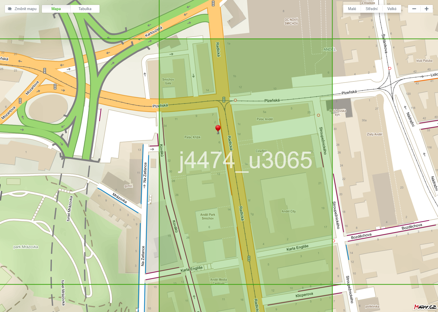
Unlike standard maps, that are available on the Internet, tactile maps are displayed on individual predefined sheets. The reason is that they are presented to users in printed (tactile) form. Single sheets in A4 format display approximately 235 x 330 m in approximate scale 1: 1200. The chosen scale suits best the depiction of the urban environment with the emphasis on the street network. Map sheets in small scale are again in A4 format and display an area of approximately 7.5 x 10.5 km at a scale of 1:37,000 and approximately 60 x 85 km at a scale of 1: 300,000.Identification of map sheets
Individual sheets are marked within a unified system with column identifiers (e.g., j4481), that are placed on the top of the sheet, and row identifiers (e.g., u3065), that are placed at the bottom of the sheet. When generating a map, the user can choose to place these identifiers either to the left, right, or center (depending on how the sheet identification affects the map drawing). The columns are marked with letters "a - r" and the rows are marked with letters "s - x". The Czech Republic is located in a rectangle marked "j" and "u". With this identification, you can easily merge and supplement already printed maps with other consecutive sheets.
What is needed to print tactile maps?
You need a laser printer, a special microcapsule paper and a fuser. If you are not fulfilling the printing conditions,or if you do not know how to print the map, contact one of the partner centers, where they will help you to print your maps.