Route planning in the Mapy.cz app
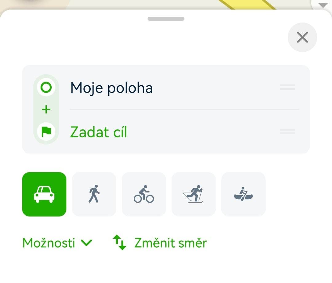
- To start the planner, simply tap the menu icon in the bottom left corner...
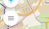
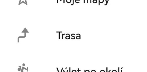
- ...and select the icon of the bent arrow labeled "Route" from the menu.
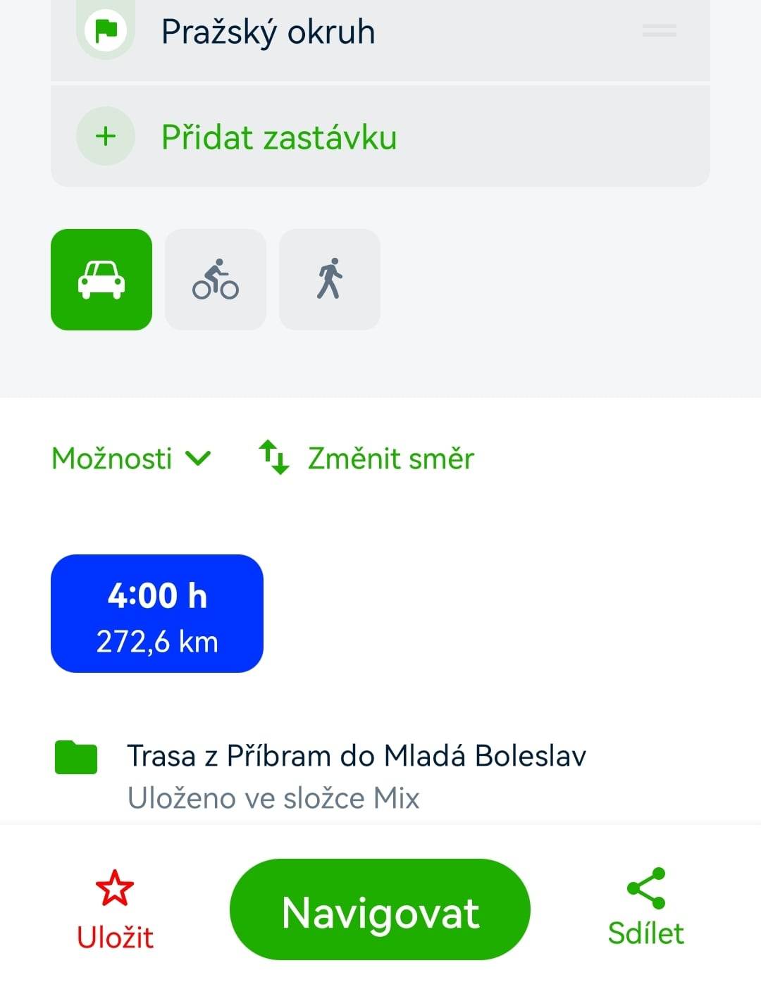
- Route planning is available for cars, cycling, walking, and cross-country skiing routes (worldwide), and even for waterways (only in the Czech Republic). Only the modes of transportation available for the planned routes will be displayed.
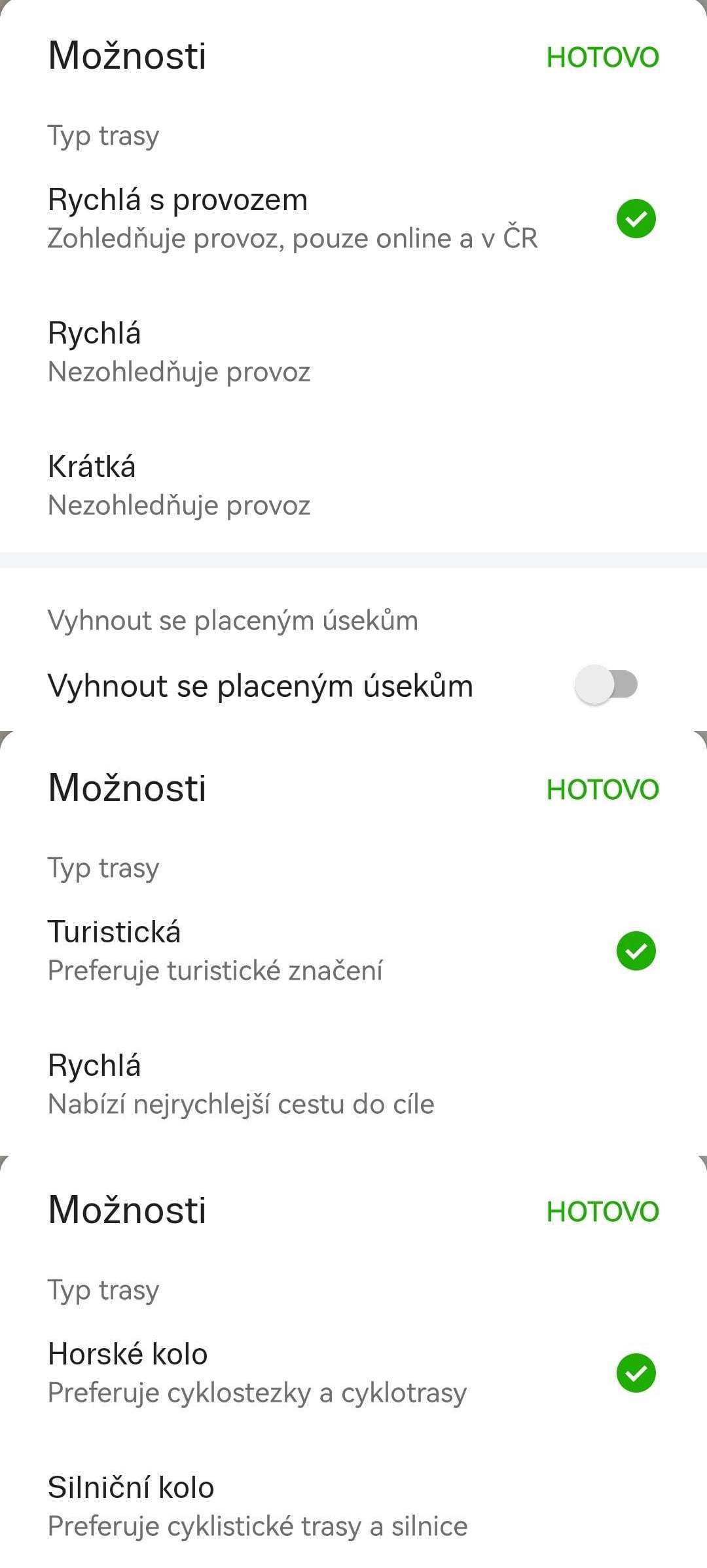
- Under the transport method option, there is a button for "Options" to refine transportation settings. You can specify preferences for planning through toll sections, favoring tourist paths, or routes suitable for road bikes. When driving through multiple countries, you can choose whether to avoid toll roads in a given country.
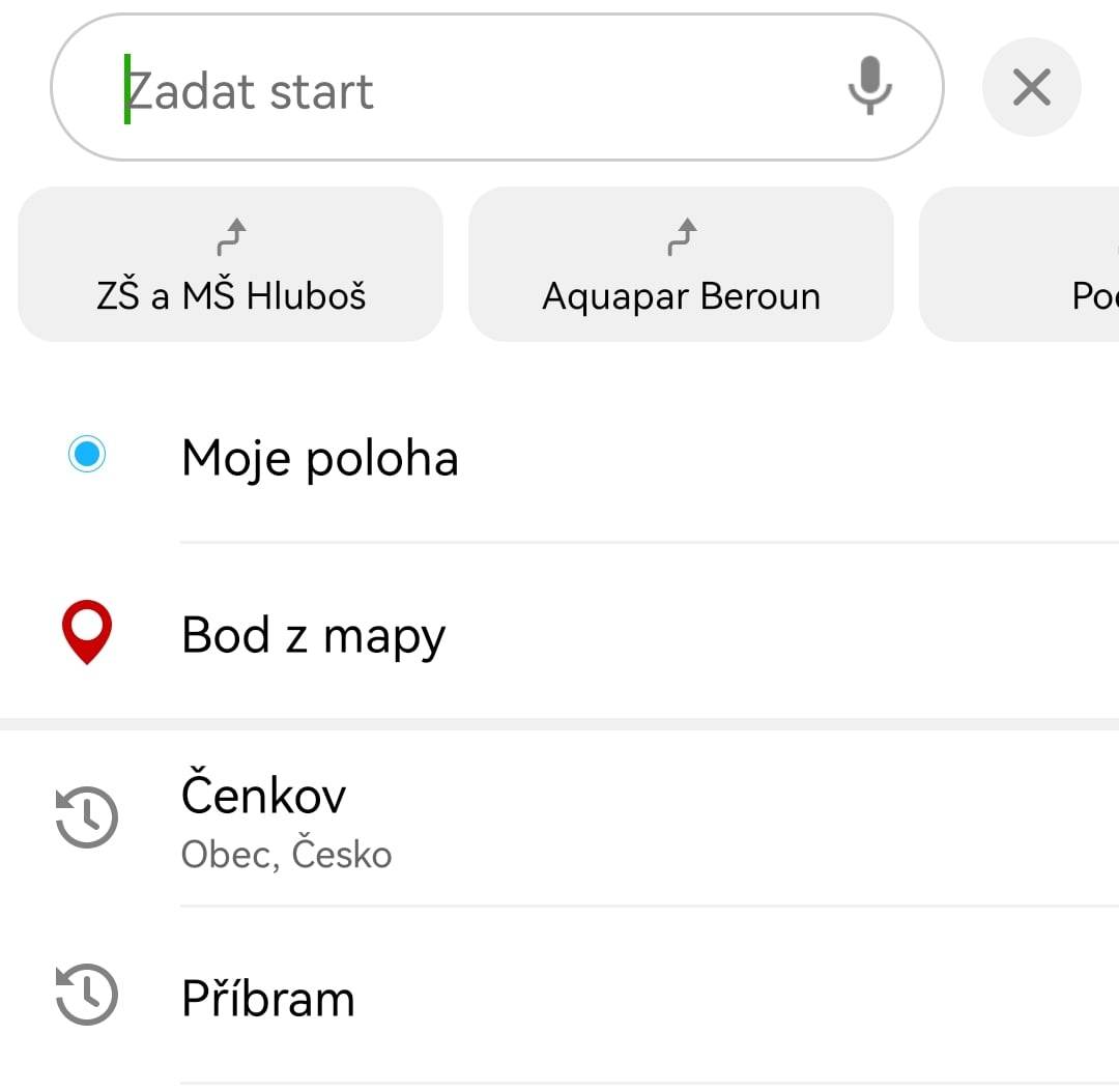
- When entering an address or point of interest, you can also use your current location, favorite destinations, search history, etc.
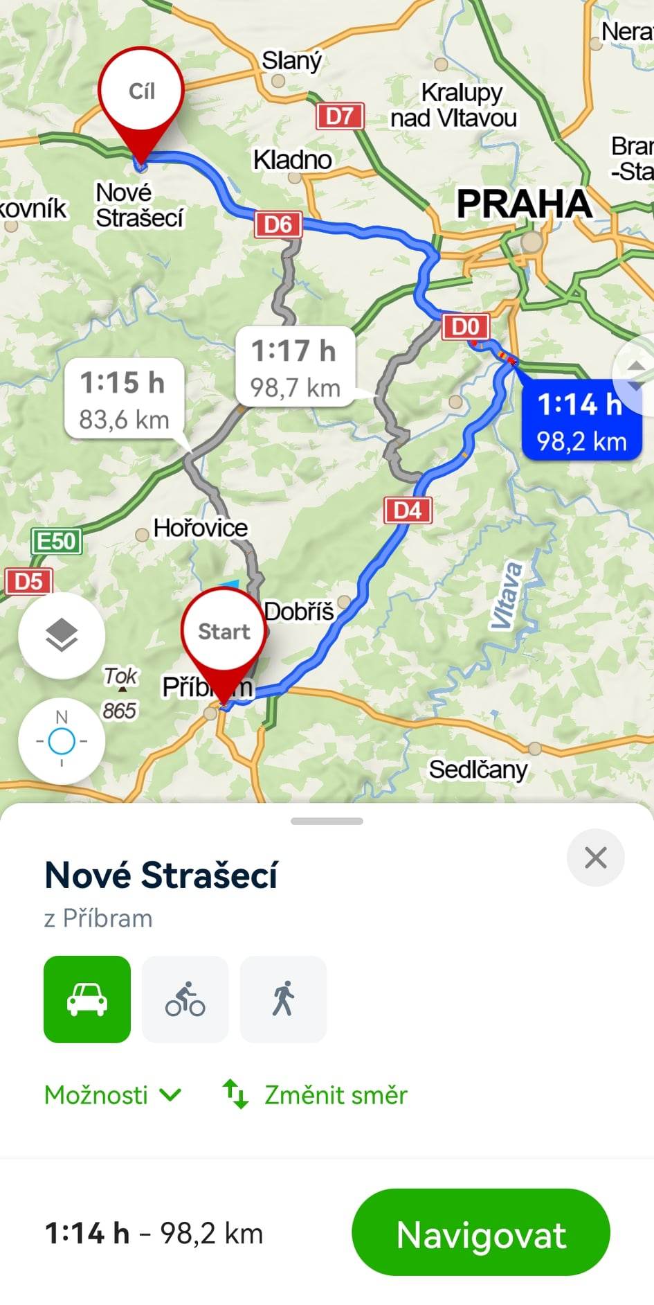
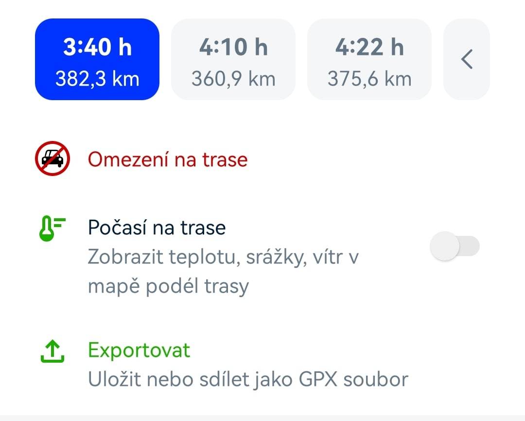
- Immediately after selecting the destination, the route is calculated and alternative routes are searched for, if available. They will be displayed on the map along with details and an elevation profile of the entire route.
- Alternatives can be selected by toggling between them both on the map and using the alternative buttons in the planner tab (individual routes are shown with travel time and distance).
- Swiping down on the screen offers the option to save the route to "My Maps" and share a link to the planned route.
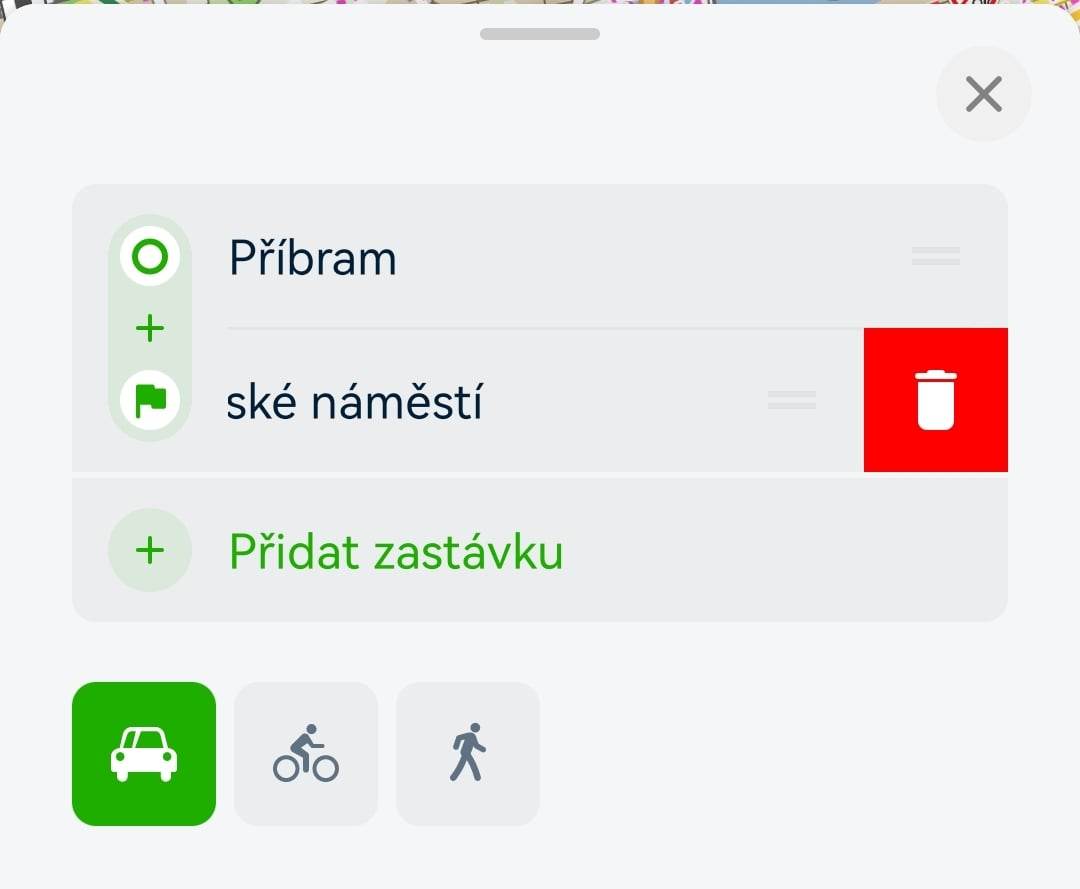
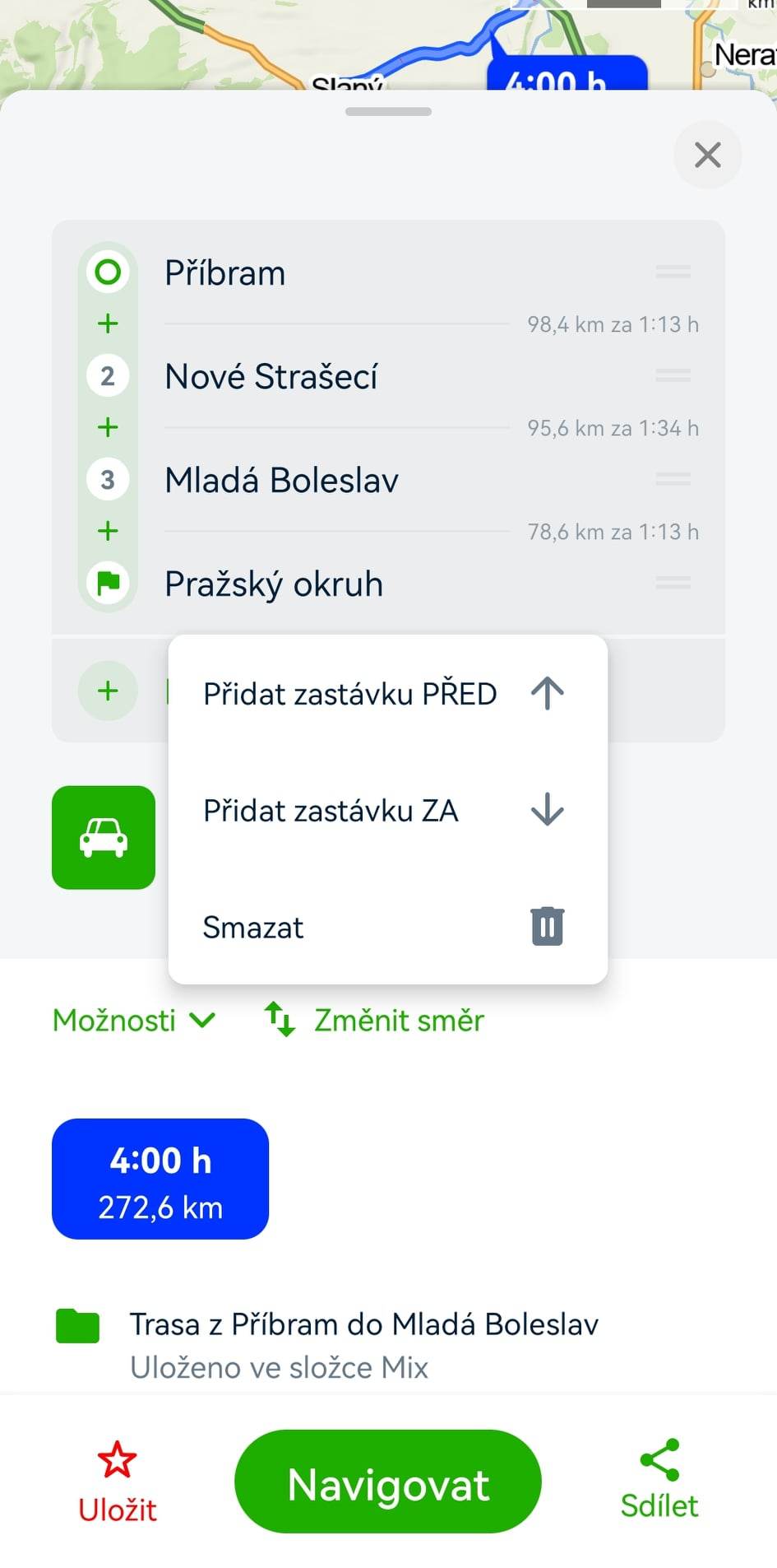
- Points on the route can be deleted with a swipe gesture (dragging to the side)—a red trash bin will appear, and tapping it will delete the point from the route. Alternatively, you can long press and then select "Delete."
Tip: You can add an unlimited number of points to the route, but it’s advisable to plan wisely. With too many points, planning can become cumbersome.
We recommend not adding waypoints at intersections, as this may cause issues during navigation later on.

- By long-pressing existing points, you can use "Add Stop Before/After" to insert additional waypoints between Start and End (Via), or add more Destinations.
- Individual items in the planner can be grabbed using the small button with two lines on the right side and dragged up or down, which will adjust and immediately recalculate the entire route.
- The "Add Stop Between Points" option is also available via the "+" button between the points.
- You can select locations directly from the map by long-pressing on the desired spot or from the details using the "Route" button.
Tapping on NAVIGATE will start the navigation to guide you along your route.
Sharing
The Share tool generates a shortened link (e.g., https://mapy.cz/s/z2ec) that leads to the map with the planned route exactly as you see it. You can simply copy the link and send it to someone. The shortened link is permanent and does not expire. You can also share the current screen on social media.
The route can also be shared using a QR code, which you can download as an image in JPG (pixels) or SVG (vectors) format from the website. You can use the downloaded QR code in printed materials, for example.
Exporting to File
Under this option, you will find links to download the route for uploading to GPS navigation systems. Exports are supported in GPX format.
When exporting to *.gpx, there are two types of output (route - only waypoint coordinates, track - the entire route).
- By car - export to *.gpx = route and track
- By bike, on foot, or on cross-country skis - export to *.gpx = track
Editing Saved Planned Routes
You can edit previously saved custom planned routes at any time, adding or removing waypoints, selecting different modes of transportation, etc.
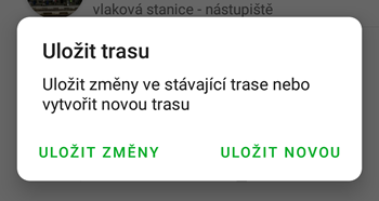
When you make any changes to an existing planned route, the green "Save" option will change to a red "Save" option.
You will then be presented with the choice to:
-
Save Changes: The changes will be saved to the existing planned route, replacing the original route.
-
Save as New: The changes will be saved as a completely new route, leaving the original planned route unaffected.
If you choose to "Save as New," you will see the standard prompt for naming the saved route and selecting its location in the chosen folder.
Mode of Transportation
When planning a route, you can select the mode of transportation—by car, public transport, bicycle, on foot, or skiing, among others. Each mode of transportation allows you to refine the route by entering additional parameters.
Route Planning by Car
The "Fast with Traffic" option reflects current traffic conditions. The estimated arrival time corresponds to the current average speeds on the roads. You can choose options to find the fastest or shortest route and avoid toll sections. These options reflect the average speed on those roads. When planning online, the route will always avoid current road closures, including regularly recurring ones offline.
Route Planning by Public Transport
This feature is currently under development and not yet available in the app.
Route Planning by Bicycle
When planning bike routes, you can select routes suitable for mountain or road bikes. For mountain bikes, the primary option is set to avoid first-class roads. When planning online, the route will always avoid current road closures, including regularly recurring ones offline. The planning speed is set at 18 km/h, which adjusts according to the elevation profile.
Route Planning on Foot
You can check a preference for hiking trails that lead around interesting places instead of the shortest possible routes. When planning online, the route will always avoid current road closures, including regularly recurring ones offline. The planning speed is set at 4 km/h, which adjusts according to the elevation profile.
Route Planning for Skiing and Cross-Country Skiing
There are no optional settings for refining routes on cross-country ski trails.
Route Planning on Water
For planning routes along selected sections of rivers in the Czech Republic, there are typically no optional settings available.
Avoid Toll Sections
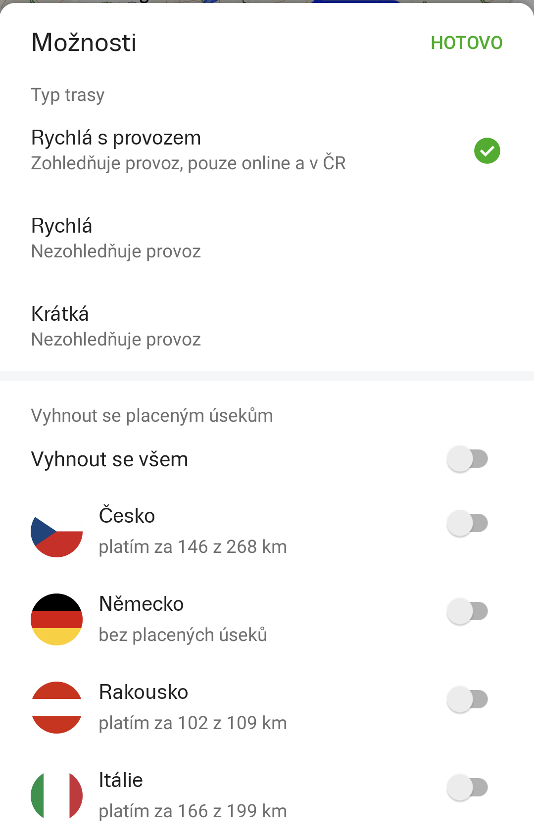 The option to "Avoid Toll Sections" allows you to plan a route by car only on sections where no toll fees are required, or where no highway sticker or vignette is necessary. In countries where you want to use toll sections, the planner displays information about the length of toll sections as part of the total route length in that country.
Route Restrictions
There are various restrictions based on the mode of transportation: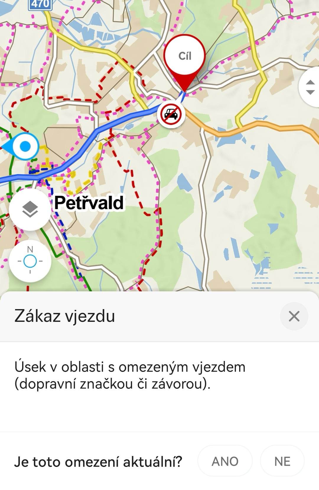
By Car:
- Closure: The section is currently closed.
- No Entry: The section is in a restricted access area (marked by a sign or barrier).
- Restricted Access Area: For example, hospitals (the section is within a closed area; entry may be restricted or subject to a fee).
- Pedestrian Zone: Areas where vehicle access is prohibited.
By Bicycle and On Foot:
- Restricted Access Area: The section is within a closed area; entry may be restricted or subject to a fee.
- No Bicycle Entry/No Entry: The section is in a military zone.
- No Bicycle Entry/No Entry: The section has restricted access due to nature conservation
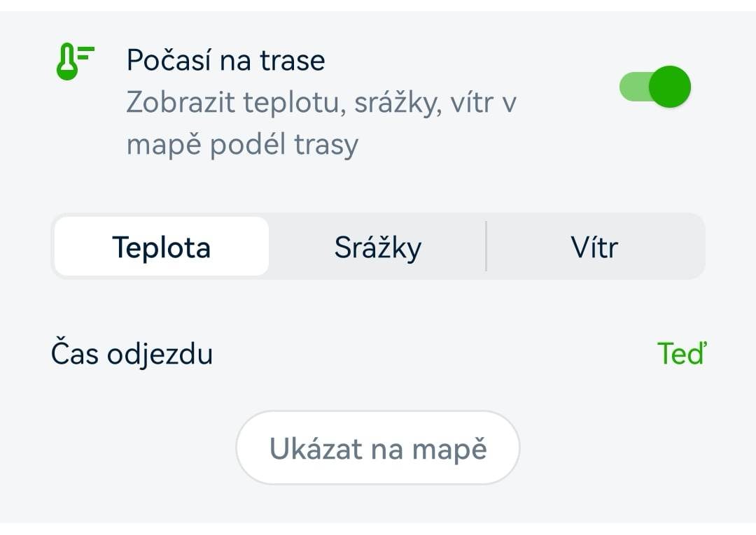
Weather on the Route
In the planner, you can enable weather information for your route. Data is available for both the route and the trip.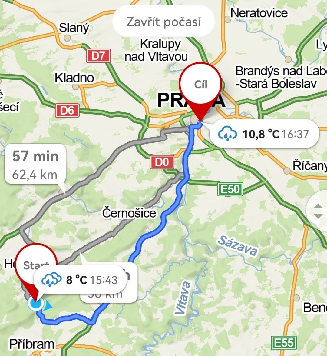
In the route bubbles, alongside specific information (icon, temperature, wind, precipitation), the time is also displayed. You can select a forecast up to 5 days in advance. Weather data is provided by Windy.com.