Plan a route by car, by bike, on skis, on the water and on foot
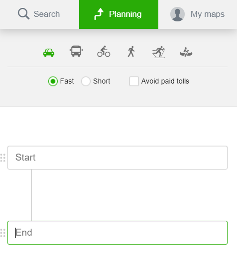
Route Planner is located on the right side of the screen at the top of the panel, under the Planning button. Route Planner allows you to plan routes between two or more locations entered either by their name, GPS coordinates, or by clicking directly on the map.
Route Planner can search and show routes directly on the map for:- Driving
- Public transport
- Cycling
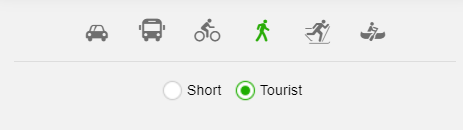
- Walking
- Skiing (seasonal)
- Sailing (seasonal)
When using the Route Planner, choose the start and the end point of the route, or eventually add waypoint(s) along the route (either by typing it in manually or by clicking on the map), to plan your trip.
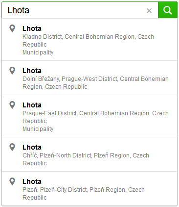
It may happen, that the name of the place you enter actually corresponds to multiple different locations with the same or similar name. In this case, select the desired location from the search suggest.
Route location
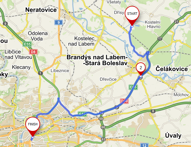
When the points are selected, the route will be displayed by black dashed line. The start and the end of the route are shown as red balloons markers, START and END.Click and drag the black dashed line to add any number of waypoints along the located route on the map.
Click and drag the balloon marker to move the location of the start and the end point of the route, or of any other waypoint along the route, as needed. The route will be always automatically recalculated.
 Waypoints can be added as needed at the start, at the end, or anywhere in the middle of the route by clicking the + button, located in the panel on the right side of the screen.
Drag and drop the dotty button in the right panel, located on the left side of each waypoint, to change the order of the waypoints already entered.
By clicking the Recycle Bin icon, located on the right side of the waypoint, the waypoint will be removed from the planner.
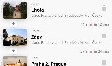
The total length of a planned route and the approximate duration of the trip are displayed in the upper part of the right panel. The waypoints always indicate the length and duration of each route section.
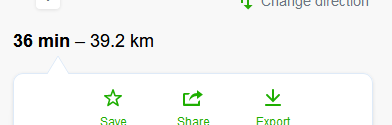
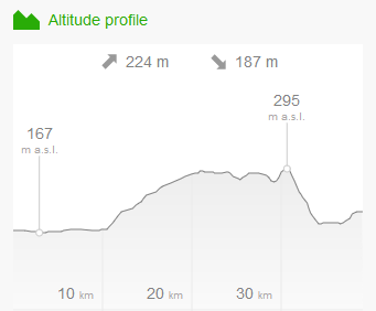
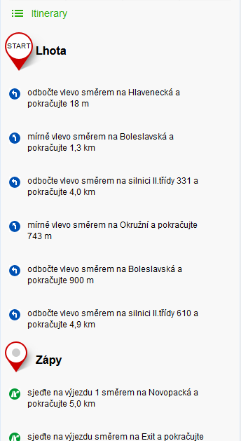
At the bottom of the right panel you will find links to view the elevation profile and the itinerary of the entire route, i.e. a detailed guidance for each section of the entire planned route.
Types of transport
When planning a route, it is possible to select between different types of transport – e.g. by car, by public transport, by bike, on foot, on skis, etc. For each type of transport, there is a menu displayed, where further parameters can be specified.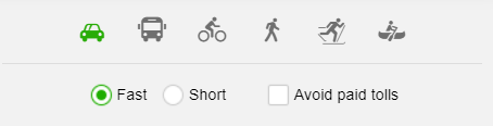 Route planning by car
When planning a route by car, you can use further options to find the fastest or shortest route and avoid paying tolls
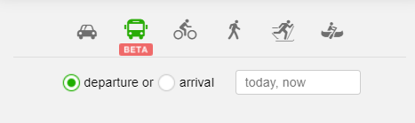
More detailed information is available in Public Trasport Help
You can choose the direction of departure or arrival and specific date and time of the route.
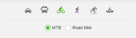
Route planning by bike
When planning a route by bike, you can use the option - mountain bike or road bike. For mountain bikes , avoiding of the 1st class-roads is pre-set.
 Route planning - walking
When planning a route, it is possible to check the preference of hiking trails leading along interesting places in comparsion to the shrotest possible routes.
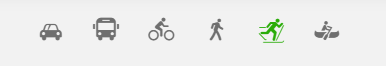 Route planning for skiing and cross-country skiing
Route planning on cross-country trails has no further options for route optimization.
 Route planning on the water
For route planning on selected river sections in the Czech and Slovak Republic, there are usually no additional options available.
Avoid toll road
The option to plan a route and avoid paying tolls allows you to plan a route by car only on the road sections where it is not necessary to pay tolls or to purchase any toll stickers or vignette.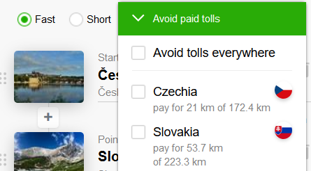
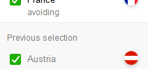
If the newly planned route avoids the country of your choice, your previously chosen preference is still available under "Previous Selection".
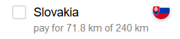
In the countries where you want to use paid road sections, the Route planner displays information about the length of the road sections with tolls from the total length of the route in that country.
Route planning from a displayed poin
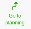 You can also plan a route from a detail of any searched or displayed POI on the map. The detail of the POI is displayed in the right panel of the screen. Click the "Go to planning" button below the name of the POI. After clicking, a search form will appear, where the selected POI is preset as the End of the Route.
For more information on how to work with additional features of the route planning, such as elevation profile, itinerary view, change of the route direction, saving to backpack, and file export, please visit the page Route Optimization Tools.
It is also possible to save, print or share the route, as well as a map without a planned route Print, Save and Share the Map.